| Local time | 2024-04-25 16:59:29 |
|---|---|
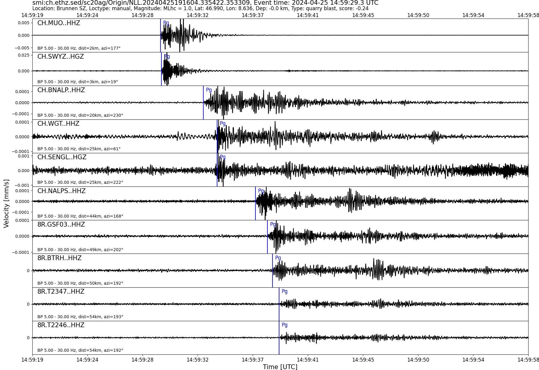
| UTC Time | 2024-04-25 14:59:29 |
| Event Type | quarry blast |
| Latitude / Longitude | 46.99 / 8.64 |
| Swiss Coordinates | 691056 / 205063 |
| Magnitude | 1.0 |
| Magnitude Type | MLhc |
| Location | Brunnen SZ |
| Depth [km] | - |
| Location Type | manual |
| Agency | SED |
| Last Update | 25-04-2024 19:16:07 |
| Danger level | 1 (as defined by federal agencies with responsibility for natural hazards) |
| Origin ID & Metadata | smi:ch.ethz.sed/sc20ag/Origin/NLL.20240425191604.335422.353309 |
|
GSE 2.1 provisional format |
|---|
| BEGIN GSE2.1 MSG_TYPE DATA MSG_ID 2024/04/25_030330574 CHE_NDC DATA_TYPE BULLETIN GSE2.1:short Reviewed Event Bulletin (REB) of the CHE_NDC for April 25, 2024, 02:59:29.653 EVENT 2024/04/25_025929653 BRUNNEN SZ Date Time Err RMS Latitude Longitude Smaj Smin Az Depth Err Ndef Nsta Gap mdist Mdist Qual Author OrigID 2024/04/25 14:59:29.65 0.73 0.24 47.0038 8.6343 0.8 8.1 10 6 165 0.02 0.67 a i uk SED -------- Magnitude Err Nsta Author OrigID MLhc 1.5 0.2 6 SED -------- Sta Dist EvAz Phase Time TRes Azim AzRes Slow SRes Def SNR Amp Per Qual Magnitude ArrID SWYZ 0.02 32.2 P 14:59:30.024 -0.2 ___ 3087.9 a__ MLhc 1.4 -------- SWYZ 0.02 32.2 S 14:59:30.872 0.3 ___ a__ MLhc 1.4 -------- MUO 0.04 177.0 P 14:59:29.950 -0.5 ___ 5292.9 a__ MLhc 1.9 -------- MUO 0.04 177.0 S 14:59:30.895 -0.1 ___ a__ -------- BNALP 0.20 227.1 P 14:59:33.470 0.1 ___ 52.1 a__ MLhc 1.2 -------- NALPS 0.42 169.1 P 14:59:37.400 -0.2 ___ 29.6 a__ MLhc 1.4 -------- NALPS 0.42 169.1 S 14:59:43.750 0.3 ___ a__ -------- GSF03 0.46 201.5 P 14:59:38.385 -0.1 ___ 40.3 a__ MLhc 1.5 -------- GSF03 0.46 201.5 S 14:59:45.120 0.3 ___ a__ MLhc 1.5 -------- FIESA 0.67 212.5 P 14:59:42.535 0.0 ___ 21.5 a__ MLhc 1.7 -------- STOP |